![]()

About
Functions to the GPlates Web Service and the GPlates Desktop Application allow users to reconstruct past positions of geographic entities based on user-selected rotation models without leaving the R running environment.
![]()
The online reconstruction (with the GPlates Web Service) makes the rotation of static plates, coastlines, and a low number of geographic coordinates available using nothing but an internet connection.
The offline reconstruction requires an external installation of the GPlates Desktop Application, but allows the efficient batch rotation of thousands of coordinates, Simple Features (sf) and Spatial (sp) objects with custom reconstruction trees and partitioning polygons. Examples of such plate tectonic models are accessible via the chronosphere.
Example
You can reconstruct the positions of the plates at 65 Ma using the Merdith et al. 2021 model and transform them to Mollweide projection using with this chunk of code:
library(rgplates)

# Rotation of plates using the GPlates Web Service
coastlines <- reconstruct("coastlines", age=65, model="MERDITH2021")

# the edge of the map (for mollweide)
edge <- mapedge()

# transform to Mollweide
epsg <- "ESRI:54009"
coastsMoll <- sf::st_transform(coastlines, crs=epsg)
edgeMoll <- sf::st_transform(edge, crs=epsg)

# plot
plot(edgeMoll, col="#1A6BB0", border="gray30")
plot(coastsMoll, border=NA, col="gray90", add=TRUE)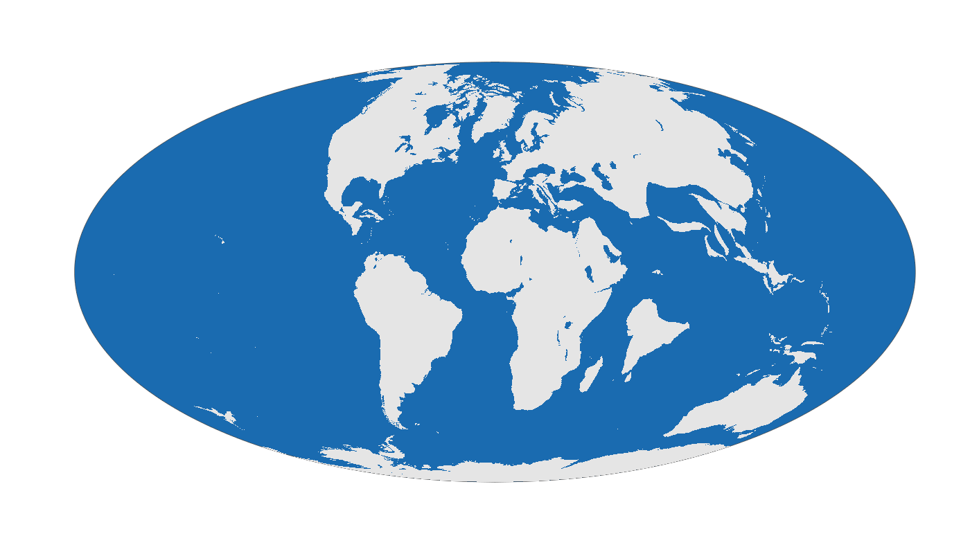
Notes
History
The functions here were originally developed and published as part of the chronosphere R package. For better compliance with UNIX philosophy and more efficient distribution/development, the original chronosphere has been broken up to three R packages:
-
chronosphere: version-controlled data distribution. -
rgplates: functions related to tectonic reconstructions. -
via: Virtual Arrays for efficient organisation of high-dimensional data.
This is a beta version, and like R, comes with absolutely no warranty.
Aim
The package was developed to make R-based analyses that require paloecoordinate rotations easier to implement, i.e. for applying a rotation model - but not as a replacement of tools dedidacted to complex paleogeographic reconstruction and model development. For more complex analyses you are more than welcome to check out gplately and pyGPlates, the awesome python packages developed by the GPlates team.